
Human activity is relentlessly changing the climate. The intensive development of energy, transport, and industry is accelerating global warming, which has already exceeded 1.3°C and is setting new records every year. The consequences are felt worldwide: extreme weather events, degradation of the foundations, changes in the oceans and glaciers, and threats to food security and human health.
Artificial intelligence technologies help to partially counteract these challenges, and annotated output is a key element in this process. A study by the Grantham Research Institute found that AI in the energy, transport, and food systems could reduce global greenhouse gas emissions by 3.2 – 5.4 billion tons of CO₂ equivalent annually by 2035. In this article, we will explore how data annotation helps preserve the environment, look at areas where green technologies are most prevalent, and discuss common problems and their solutions.
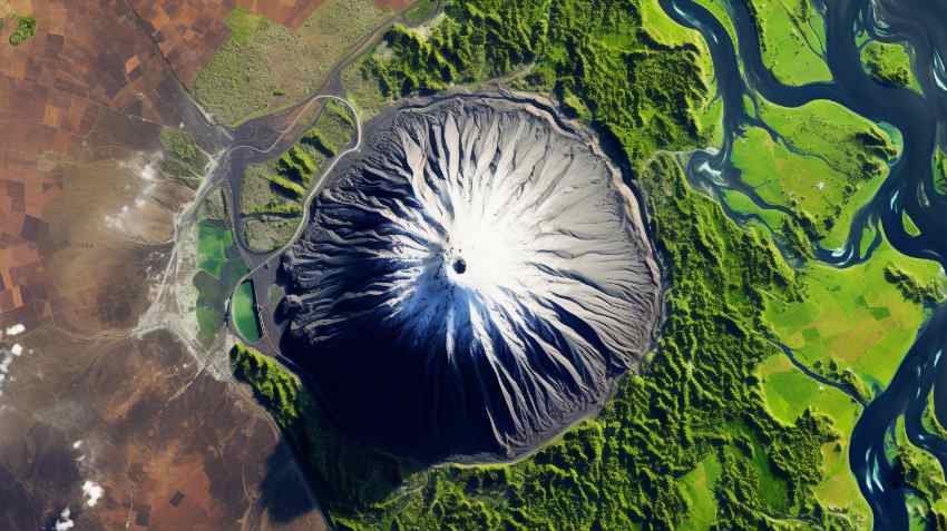
From satellite imagery to weather forecasts
Drones for monitoring forests, along with sensors for tracking the condition of soils and water, help detect deforestation, land degradation, and water pollution. One example is the ESA Sentinel-1 for Science project: ESA’s Amazonas uses radar data from Sentinel-1 satellites, combined into a “data cube”, to detect forest loss every ~12 days. Over 5.2 million hectares of deforestation were recorded between 2017 and 2021. Such data helps scientists assess the effectiveness of conservation programs and preserve biodiversity.
Data annotation is becoming a key element for integrating different sources of information, including satellite images, radars, and ground sensors. New satellites, such as NASA’s and ISRO’s NISAR, are capable of covering nearly all land and ice surfaces daily, enabling the creation of detailed maps of climate change.
Annotated satellite and radar images help artificial intelligence recognize patterns and relationships between weather factors that are often inaccessible to traditional forecasting methods. This enables the prediction of precipitation, extreme weather events, temperature, and wind speed, which benefits the agricultural sector, urban planning, energy, and transportation. It also helps society adapt to the consequences of climate change by planning water resources, implementing drought strategies, optimizing agriculture, and preparing for extreme weather conditions.
For example, Microsoft Research’s “Towards Flood Extent Forecasting: Evaluating a Weather Foundation Model and U‑Net for Flood Forecasting” ClimaX model combines satellite and ground-based data to predict the daily spread of flooding. This allows local authorities to plan for evacuations and reduce damage from natural disasters.
Agriculture increasingly relies on data and artificial intelligence algorithms. Annotating different types of plants, their growth stages, canopy density, and health helps train AI to determine which areas of the field need irrigation and which receive enough moisture naturally. Keymakr has become one of the players implementing these technologies in practice and providing accurate data labeling for the agricultural sector. On its own platform, Keylabs creates and annotates datasets, which are then trained on by an AI model. This helps to avoid over-watering, distribute water correctly, and reduce energy consumption associated with irrigation systems.
Real-life examples of how data protects nature
Ocean сleanup
Annotated data from satellite images and cameras on marine buoys help identify places where plastic accumulates in the ocean. The Ocean Cleanup project, where algorithms trained on annotated images recognize floating garbage fields in the Pacific Ocean. Between 2020 and 2024, the organization successfully removed over 13,000 tons of plastic.
Garbage sorting
An AI-based Waste Sorting Robot is an AI system in automatic sorting centers that recognizes materials: paper, plastic, and metal. Thanks to training on large annotated datasets, the sorting system achieved an accuracy of over 99,3%, which enabled an increase in waste recycling levels, and the amount of waste sent to landfills decreased.
Land and soil regeneration
The Collaborative Rangelands Restoration in Jordan project, led by the Royal Botanical Gardens of Jordan, has been designated as the UN Flagship for Ecosystem Restoration in 2025. It aims to revive the traditional Arab land management system of Al-Hima. Remote sensing and GIS analysis were used to monitor the efficiency and health of the rangelands. This project restored 180 hectares of degraded land, increased biomass production by a factor of 8, and more than doubled the income of local herders.
Challenges and solutions
Numerous challenges can complicate and slow down the data annotation process. The main ones are:
Data quality: Sensors can be inaccurate, and satellite imagery has uncertainties. The study “Impact of Training Data Uncertainty on Machine Learning-Based Habitat Classification in Coastal Zones” (2025)confirms that uncertainty in manual annotation of ecological data is a significant cause of low accuracy of AI models. This leads to erroneous mapping of important ecosystems and reduces the effectiveness of conservation measures.
Scope and availability: Many datasets are limited to a region or season, and some datasets are paid or come in different formats. For example, the climatological dataset HighResClimNevada (2025) has a resolution of ~1 km for a region of southern Spain. In the paper, the authors point out that “observational data in this region are short and contain errors due to instrumental imprecision or poor calibration” and that “satellite products often have significant uncertainties and short time series”.
Ethical aspects: Training AI models requires large amounts of data on climate, energy, environmental indicators, and human behavior. This raises issues of privacy and data protection. The article “Privacy‑Preserving Analytics for Smart Meter (AMI) Data: A Hybrid Approach to Comply with CPUC Privacy Regulations” (2025) shows that privacy‑preserving approaches have been used to analyze energy consumption data from “smart meters”: anonymization, differentiated privacy, federated learning, cryptographic methods, etc. This has allowed analytics to be performed without revealing sensitive information about individual households.
Sensor calibration, data verification, synthetic and crowdsourced datasets, format standardization, and open platforms are used to overcome these challenges. It is also essential to protect privacy and use federated learning to analyze sensitive data, such as energy consumption.
Innovation and expectations in climate AI
In the field of climate technology, key innovations are focused on developing high-precision AI models for environmental monitoring.
These include:
- High spatial resolution. Machine learning technologies utilize satellite data to create detailed maps of urban emissions, enabling the precise identification of pollution sources.
- Hourly transport modeling. AI integrates big data to provide hourly traffic modeling and estimates of CO₂ emissions at the street level, which is important for real-time urban flow management.
- Acoustic monitoring. In the field of biodiversity, AI systems are being implemented to analyze acoustic data and monitor populations, detecting early signs of stress in ecosystems.
Future expectations are focused on the transition to predictive ecology. This means developing multifunctional early warning systems that can predict not only the weather but also the risks of invasive species spread, as well as model the migration routes of wild animals under the influence of climate change.