Vexcel Imaging, headquartered in Graz, Austria, is a global leader in airborne geospatial technology. Founded in 1992, the company combines more than 30 years of expertise in optics, camera design, data processing and large-scale mapping. What makes Vexcel unique is its fully integrated ecosystem: high-performance aerial sensors, hybrid camera-LiDAR systems, advanced photogrammetric processing software and the world’s largest aerial imagery and geospatial data program.
Interview with Alexander Wiechert, CEO of Vexcel Imaging.
A brief description of the company and its activities.
Alexander Wiechert: The UltraCam family and UltraMap software set industry standards for flying efficiency, versatility, accuracy and image quality as well as automated data processing, workflow productivity and innovative software features. Complementing its hardware and software, the continuously updated Vexcel Data Program delivers fresh national-scale high-resolution imagery, 3D models and geospatial data used across government, commercial and AI-driven applications. Together, this ecosystem enables Vexcel to capture and process reality at global scale with one mission: providing the highest-quality imagery and data possible —fueling automation, analytics and digital twins worldwide.
What are the main areas of activity of the company?
A.W: Vexcel focuses on three core areas:
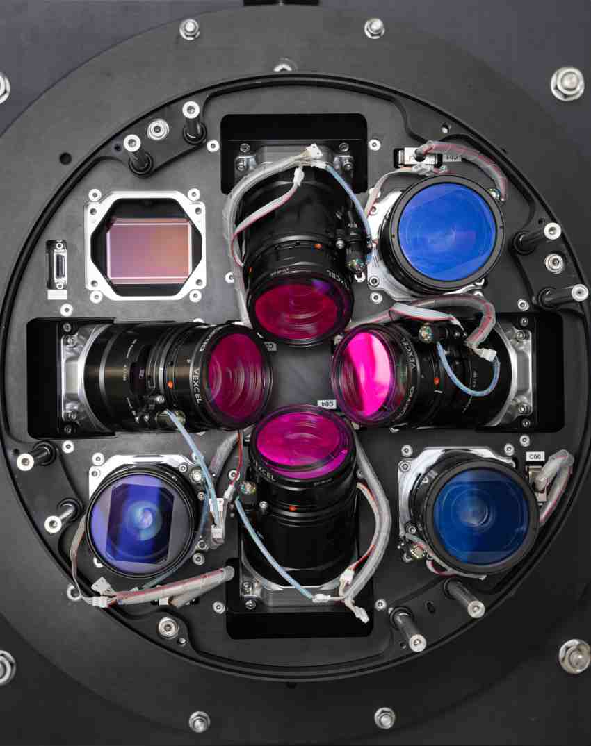
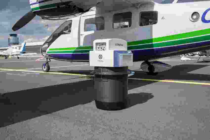
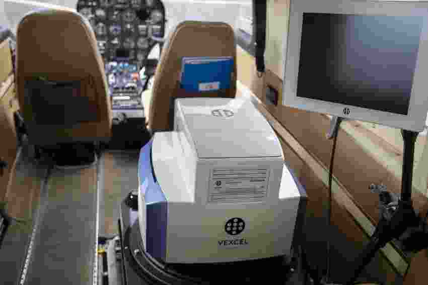
- Aerial imaging hardware: Development and manufacturing of large-format aerial cameras and hybrid camera–LiDAR systems.
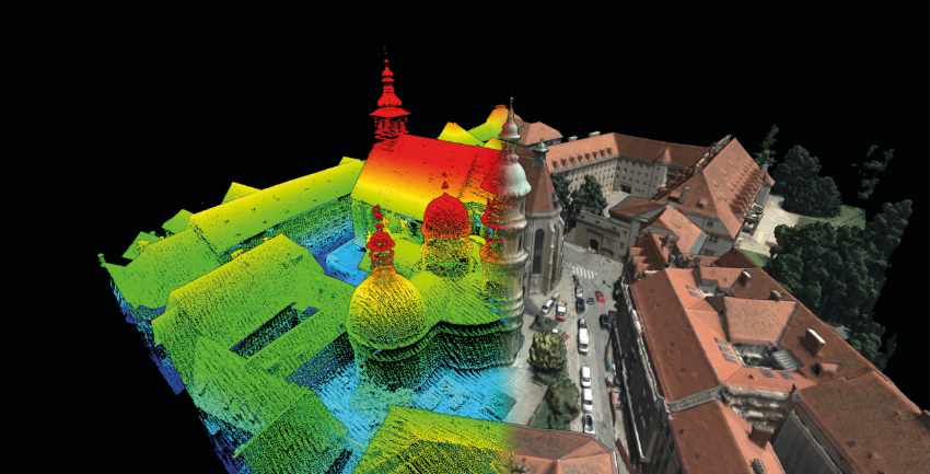
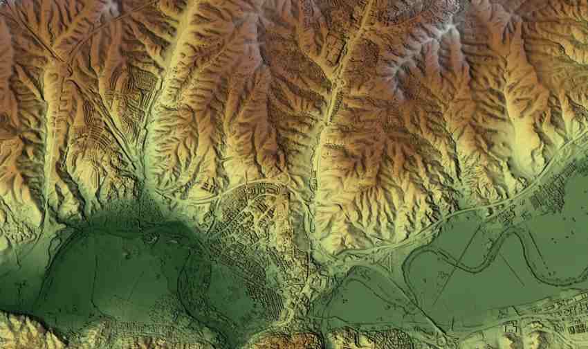
- Photogrammetric software: UltraMap provides advanced workflows generating imagery-derived dense point clouds, Digital Surface Models (DSMs), Digital Terrain Models (DTMs), orthophotos and detailed 3D models.
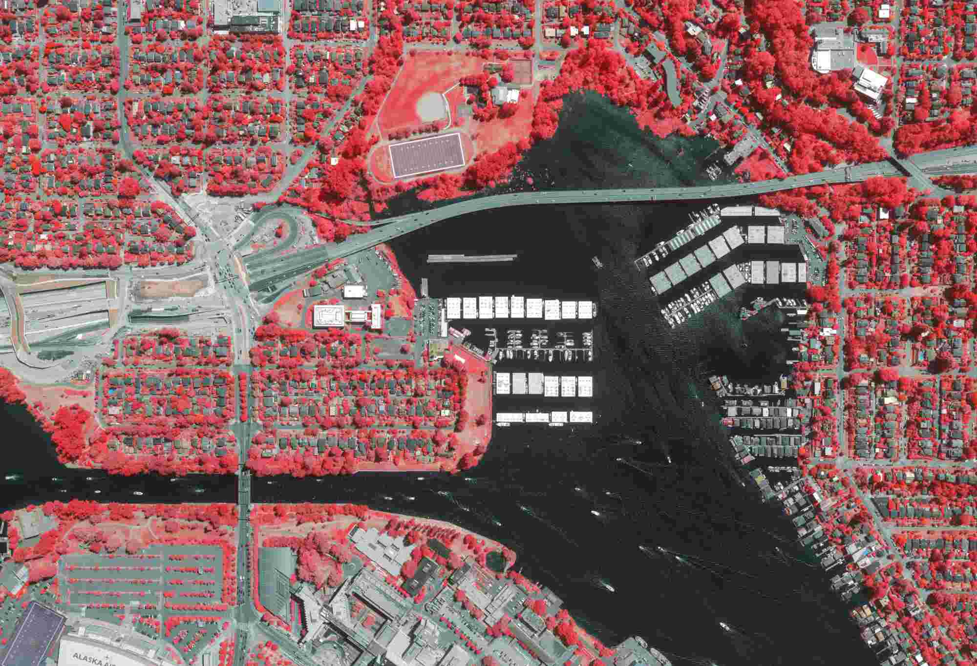
- Global geospatial data services: Through the Vexcel Data Program, Vexcel captures, processes and delivers high-quality imagery and 3D datasets in 40+ countries—continuously refreshed to ensure up-to-date coverage for GIS, infrastructure, insurance, public safety and environmental applications.
These activities are supported by extensive integration expertise, global service, partner training and long-term customer support.

What’s the news about new products/services?
A.W: In 2025, Vexcel is introducing a new series of systems built around Sony’s cutting-edge IMX811 CMOS sensor with 247 MP and a 2.81 µm pixel size, setting new standards in image quality, radiometric performance and efficiency.
The new model range includes:
- UltraCam Osprey 4.2 – a high-performance nadir/oblique system with 22% improved flight efficiency.
- UltraCam Merlin 5.0 – a next-level true-nadir photogrammetry camera featuring 37,500 pixels across track, user-exchangeable lenses, fast capture rates and enhanced pixel processing for higher accuracy.
- UltraCam Dragon 4.2 – a powerful hybrid system combining high-resolution nadir and oblique imagery with a 2.4 MHz RIEGL waveform LiDAR scanner for advanced 3D mapping and urban modelling.
Alongside these hardware updates, the Vexcel Data Program continues expanding country coverage and delivering higher-resolution imagery and 3D data products worldwide.
What are the ranges of products/services?
A.W: Vexcel’s offering spans the full geospatial imaging and data workflow:
- UltraCam aerial cameras for nadir, oblique and wide-area mapping (Merlin, Eagle, Osprey, Condor).
- Hybrid camera–LiDAR systems enabling precision 3D data capture in a single flight (Dragon).
- UltraMap photogrammetry software generating orthophotos, DSM/DTM products, dense point clouds and textured 3D models.
- Flight management and integration tools including GNSS-INS systems (UltraNav), stabilized UltraMounts and high-performance data storage units.
- Vexcel Data Program, delivering constantly updated nationwide imagery collections with oblique imagery, multispectral imagery, orthophotos, Digital Surface Models and detailed 3D cities models. The program is supported by a robust platform and API ecosystem—Vexcel Viewer, Vexcel APIs, Image Services for ArcGIS, MapControl SDK and WMTS—allowing seamless integration into existing workflows.
- Training, support and professional services ensuring long-term system performance and operational efficiency.
What is the state of the market where you are currently active?

A.W: The aerial mapping and geospatial data market is experiencing strong global growth as industries and governments increasingly depend on accurate, frequently updated spatial information. Smart-city development, climate resilience, infrastructure modernisation and digital twins are major drivers. While drones and satellites expand the market, large-format aerial systems remain essential for national-scale coverage, high detail and consistent quality. The Vexcel Data Program supports this demand by providing turnkey, continuously refreshed imagery and 3D data to organizations that require reliable geospatial coverage without operating their own collection systems.
What can you tell us about market trends?
A.W: Key industry trends include:
- Growing demand for 3D models and digital twins, especially in urban environments.
- Increased use of imagery–LiDAR fusion for richer datasets and automated analysis.
- AI-enhanced photogrammetry accelerating modelling, classification and change detection.
- Expansion of subscription-based geospatial data programs, such as the Vexcel Data Program.
- Higher expectations for efficiency, pushing for larger footprints, faster frame rates and more automated software pipelines.
What are the most innovative products/services marketed?
A.W: Vexcel’s innovation stems from the synergy between its sensor technology, processing software and global data collection. The UltraCam series continues to set benchmarks in image quality, stability and productivity. Hybrid systems combine LiDAR and imagery in a single sensor suite, offering unmatched versatility for 3D mapping. UltraMap’s automated, integrated workflow significantly expands what customers can achieve with captured data.
The Vexcel Data Program is equally innovative, providing high-resolution national imagery, oblique views, DSMs and 3D models at scale, continuously updated. Its ready-to-use datasets allow organizations to leverage advanced analytics, automation and digital twin applications without conducting their own flights.
What estimations do you have for the end of 2025?
A.W: Bylate 2025, Vexcel expects sustained global growth in aerial mapping demand and an accelerated shift toward integrated 2D and 3D geospatial data ecosystems. The company anticipates broader adoption of hybrid imaging–LiDAR solutions and further automation in photogrammetric workflows. The Vexcel Data Program is projected to expand into additional countries and offer higher-resolution data products, supporting a wide range of industries that increasingly rely on timely, accurate geospatial information. Overall, Vexcel foresees strong revenue and innovation momentum, driven by the continued global need for high-quality aerial imagery and 3D geospatial data.