R3GIS is an Italian company specializing in the development of Web-GIS and mobile applications for the management of urban green infrastructure and geospatial data, and innovative tools for smart cities. Founded in 2003 and headquartered in Bolzano, Italy, R3GIS focuses on creating intuitive software solutions that integrate spatial information with various databases used by municipalities and public bodies, connecting the stakeholders involved in management.
What are the main areas of activity of the company?
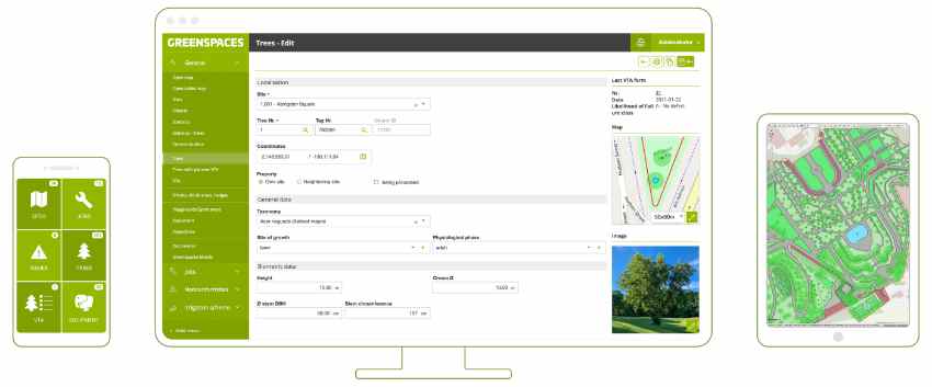
Urban Green Management: Providing the GreenSpaces platform for the effective management of urban greenery. The solution is adaptable for public or private entities and has a broad range of modules suited to various customer requirements.
Facility Management: Developing solutions like WorkSpaces and RoadSpaces for the management of public and private assets, including buildings, utility infrastructure and road signage.
What are the news about new products/services?
R3GIS continually invests in research and development to enhance its product offerings. Recent initiatives include integrating environmental sensors within the GreenSpaces platform to optimize tree health and resource management. For instance, the incorporation of TreeSense technology allows real-time monitoring of trees’ water needs, facilitating smarter irrigation practices and promoting sustainable urban greenery.
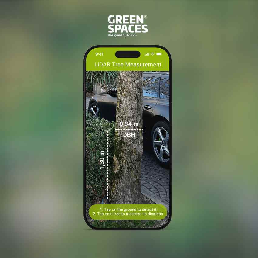
On the mobile front, the mobile application is fully available for iOS devices. As an innovative feature, we are developing an array of use cases for the LiDAR functionality available in the new smartphones. The alpha version of the demo will enable the quick and accurate measurement of tree diameters directly in the field. This measurement is integrated and stored within the GreenSpaces platform, eliminating the need for a manual input.
What are the ranges of products/services?
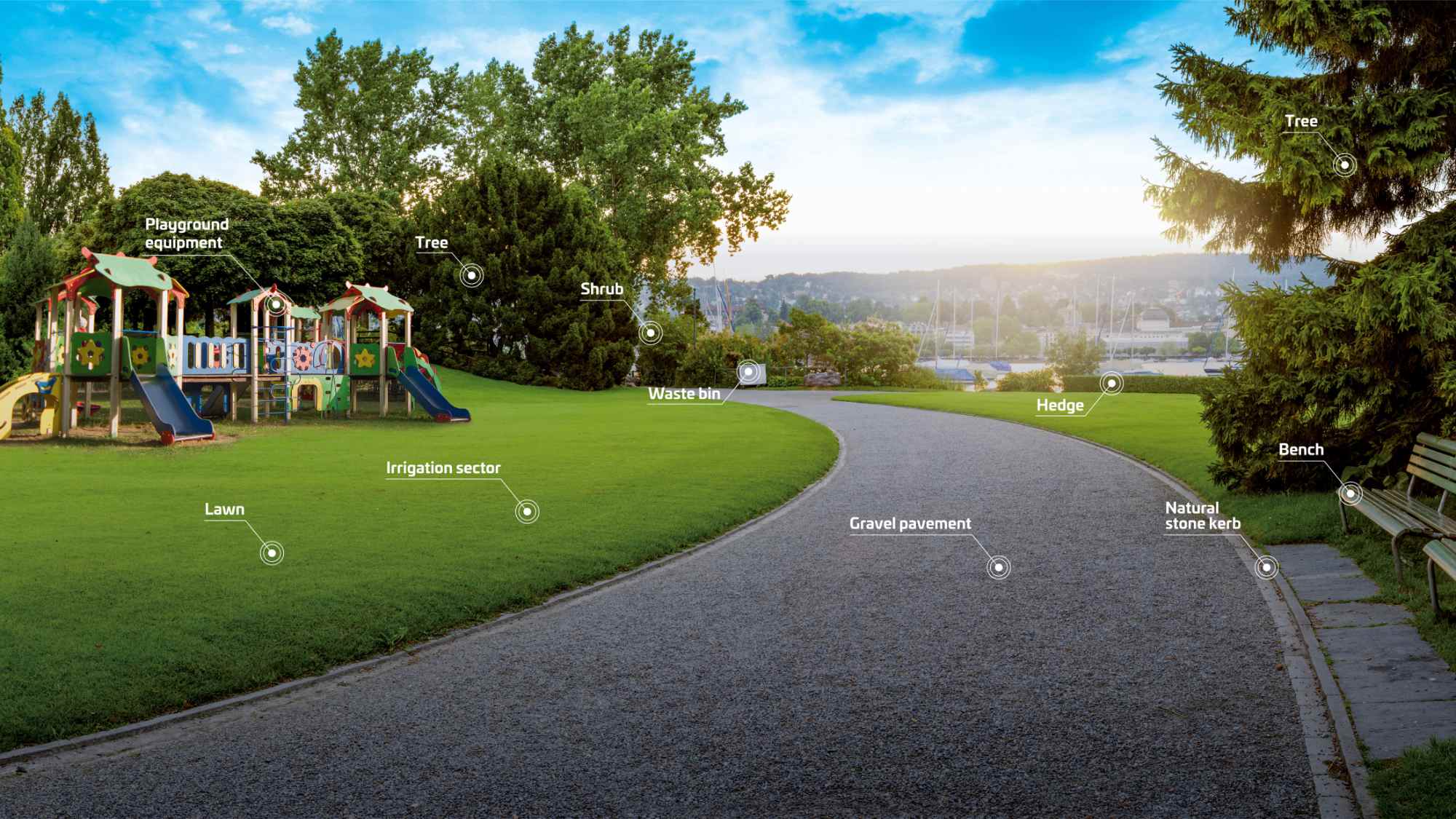
GreenSpaces: A comprehensive platform for the management of urban green areas, including trees, playgrounds, and other public spaces. It offers modules for tree risk assessment, maintenance scheduling, ecosystem service quantification, and a public transparency portal for citizens.
WorkSpaces: A Web-GIS framework designed for managing information, documentation, and maintenance workflows related to assets such as buildings and infrastructure.

RoadSpaces: A platform that assists in creating and managing a digital registry of traffic signs, road markings, and other road infrastructure, helping authorities comply with regulatory requirements.
Complimentary solutions
ArboTag: A tree identification system that streamlines the physical tagging, management and monitoring of urban trees.
Greehill: A digital twin solution for maintaining smart tree inventories, providing highly precise and easily scalable data on urban forests.
TreeSense: Real-time monitoring of trees’ water balance and tree health.
What is the state of the market where you are currently active?
The market for geospatial data management solutions is experiencing growth, driven by the increasing need for efficient urban planning and sustainable development. Cities worldwide are investing in smart city technologies to enhance the management of public assets, including green spaces, infrastructure, and transportation systems.
Private entities are also looking for solutions to enable the efficient management of their green areas. Starting in 2025 European companies will have to disclose their carbon footprint, and having an inventory of their green assets is going to be important for “green bookkeeping”.
What can you tell us about market trends?
Urban green space management is undergoing significant transformations influenced by technological advancements, environmental concerns, and urbanization trends. Below is a detailed analysis of current market trends, supported by relevant statistics and data.
Recent studies have highlighted a concerning reduction in urban green areas globally. The 2024 Urban Green Space Report by Husqvarna Group analyzed satellite data from 344 cities across 62 countries, revealing that 75% of these cities experienced a decrease in green spaces. The net loss amounted to 63 million square meters compared to the previous year, primarily due to urban expansion and construction activities. Europe, however, maintained the highest average urban green space coverage at 47%, while regions like South and West Asia averaged 25%.
The demand for urban planning software and services, integral to effective green space management, is on the rise. In 2024, the global market was valued at USD 156.89 billion and is anticipated to grow at a CAGR of 6.8% from 2025 to 2030. This growth is driven by increasing urbanization, technological advancements in Geographic Information Systems (GIS), and a heightened focus on sustainable development.

What are the most innovative products/services marketed?
R3GIS’s GreenSpaces platform stands out as an innovative solution in urban green management. It integrates advanced technologies such as digital twins and AI-driven monitoring to provide detailed virtual representations of urban trees, enabling constant and accurate monitoring of their health and growth.
GreenSpaces is the only platform which combines day to day management with a detailed calculation of environmental benefits provided by green infrastructure, like carbon sequestration, cooling and air amelioration.
Additionally, the platform’s integration with tools like the Husqvarna Urban Green Space Index (HUGSI) allows cities to evaluate their performance against similar cities, fostering continuous improvement in green space management practices.
What estimations do you have for the beginning of 2025?
As of March 2025, R3GIS has demonstrated a strong commitment to innovation and collaboration. R3GIS’s involvement in projects such as the European Urban Initiative project TALEA and the Interreg Italy-Austria BioBox reflects its dedication to fostering partnerships and contributing to transform scientific knowledge into easy to use tools to improve management of open spaces.Overall, R3GIS is well-positioned to continue its growth trajectory by leveraging its expertise in geospatial data management and its focus on delivering innovative solutions for smart cities.


